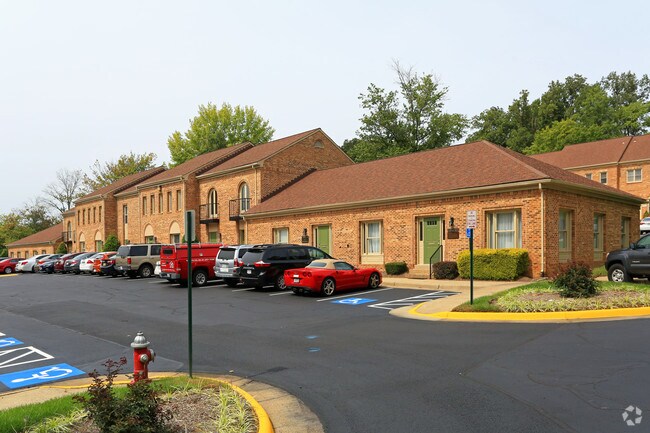
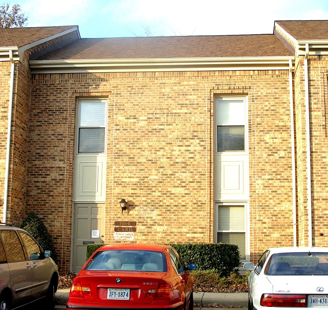
Property Record
5101F Backlick Rd, Annandale, VA 22003

NEARBY LISTINGS FOR SALE OR LEASE
Property Detail
5101F Backlick Rd
Washington-Arlington-Alexandria, DC-VA-MD-WV
Springdale Professional Center Condo
0714-28-0028
SPRINGDALE PROFFESSIONAL CENTER CONDO UNIT 32 PHASE 3
Officecondo
Fairfax
X
Virginia
5100540050D
32
2024
0.03 AC
2025
Annandale
452101
Washington, DC
2,080 SF
DEMOGRAPHICS near 5101F Backlick Rd
1 Mile
3 Mile
5 Mile
2024 Total Population
11,269
136,245
433,834
2029 Population
11,093
133,934
426,885
Pop Growth 2024-2029
(1.56%)
(1.70%)
(1.60%)
Average Age
42
40
39
2024 Total Households
3,538
47,394
162,584
HH Growth 2024-2029
(1.72%)
(1.89%)
(1.73%)
Median Household Inc
$136,442
$109,784
$112,826
Avg Household Size
2.90
2.70
2.60
2024 Avg HH Vehicles
2.00
2.00
2.00
Median Home Value
$637,956
$602,960
$621,490
Median Year Built
1967
1969
1973
Nearby Places
Map Layers
Map Styles
 Street
 Aerial
- Restaurants
- Banks
- Shops
- Fitness
- Groceries
PUBLIC TRANSPORTATION
COMMUTER RAIL
Backlick Road (Manassas Line - Virginia Railway Express)
DRIVE
WALK
Distance
Backlick Road (Manassas Line - Virginia Railway Express)
5 min
1.6 mi
Franconia-Springfield (Fredericksburg Line - Virginia Railway Express)
DRIVE
WALK
Distance
Franconia-Springfield (Fredericksburg Line - Virginia Railway Express)
15 min
5.8 mi
AIRPORT
Ronald Reagan Washington Ntl
DRIVE
WALK
Distance
Ronald Reagan Washington Ntl
19 min
10.3 mi
Washington Dulles International
DRIVE
WALK
Distance
Washington Dulles International
40 min
24.3 mi
Freight Ports
Port of Baltimore
DRIVE
WALK
Distance
Port of Baltimore
77 min
51.5 mi
SALE & LEASE HISTORY
LISTING DATE
SALE/LEASE

Mar 18, 2019
For Sale
Jul 24, 2018
For Sale
Jan 10, 2022
For Sale
Aug 05, 2017
For Sale
Apr 22, 2019
For Lease
Apr 10, 2018
For Lease
Nearby Properties
Address
Land Use
TOTAL SIZE
Lot Size
Zoning
Address
Land Use
TOTAL SIZE
Lot Size
Zoning
824,193 SF
16.06 AC
400
Address
Land Use
TOTAL SIZE
Lot Size
Zoning
613,844 SF
499
Address
Land Use
TOTAL SIZE
Lot Size
Zoning
1,031,040 SF
36.16 AC
220
Address
Land Use
TOTAL SIZE
Lot Size
Zoning
853,724 SF
32.32 AC
220
Address
Land Use
TOTAL SIZE
Lot Size
Zoning
429,735 SF
20 AC
560
Address
Land Use
TOTAL SIZE
Lot Size
Zoning
329,637 SF
23.39 AC
316
Address
Land Use
TOTAL SIZE
Lot Size
Zoning
431,097 SF
16.45 AC
220
Address
Land Use
TOTAL SIZE
Lot Size
Zoning
452,682 SF
20.74 AC
220
Address
Land Use
TOTAL SIZE
Lot Size
Zoning
415,368 SF
21.06 AC
220
Address
Land Use
TOTAL SIZE
Lot Size
Zoning
485,839 SF
22.59 AC
460
Address
Land Use
TOTAL SIZE
Lot Size
Zoning
485,499 SF
19.11 AC
220
Address
Land Use
TOTAL SIZE
Lot Size
Zoning
8.03 AC
RC
Address
Land Use
TOTAL SIZE
Lot Size
Zoning
511,000 SF
34.16 AC
596
Address
Land Use
TOTAL SIZE
Lot Size
Zoning
10.39 AC
Address
Land Use
TOTAL SIZE
Lot Size
Zoning
253,647 SF
5.99 AC
220
Address
Land Use
TOTAL SIZE
Lot Size
Zoning
173,702 SF
6.72 AC
316
Address
Land Use
TOTAL SIZE
Lot Size
Zoning
263,550 SF
1.78 AC
I
Address
Land Use
TOTAL SIZE
Lot Size
Zoning
5.10 AC
RC
Address
Land Use
TOTAL SIZE
Lot Size
Zoning
325,576 SF
13.06 AC
RA
Address
Land Use
TOTAL SIZE
Lot Size
Zoning
505,632 SF
22.11 AC
RA
Address
Land Use
TOTAL SIZE
Lot Size
Zoning
396,224 SF
6.57 AC
RC
Address
Land Use
TOTAL SIZE
Lot Size
Zoning
281,630 SF
16.07 AC
540
Address
Land Use
TOTAL SIZE
Lot Size
Zoning
398,419 SF
18.54 AC
560
Address
Land Use
TOTAL SIZE
Lot Size
Zoning
246,246 SF
10.84 AC
I
Address
Land Use
TOTAL SIZE
Lot Size
Zoning
124,351 SF
14.60 AC
460
Address
Land Use
TOTAL SIZE
Lot Size
Zoning
158,919 SF
6.15 AC
316
Address
Land Use
TOTAL SIZE
Lot Size
Zoning
153,341 SF
11.96 AC
460
Address
Land Use
TOTAL SIZE
Lot Size
Zoning
106,170 SF
8.39 AC
460
Address
Land Use
TOTAL SIZE
Lot Size
Zoning
253,648 SF
10.72 AC
550
The World's #1 Commercial Real Estate Marketplace
Connect with us
© 2025 CoStar Group
The information above has been obtained from sources believed reliable. While we do not doubt its accuracy we have not verified it and make no guarantee, warranty or representation about it. It is your responsibility to independently confirm its accuracy and completeness. Any projections, opinions, assumptions, or estimates used are for example only and do not represent the current or future performance of the property. The value of this transaction to you depends on tax and other factors which should be evaluated by your tax, financial, and legal advisors. You and your advisors should conduct a careful, independent investigation of the property to determine to your satisfaction the suitability of the property for your needs.